|
|
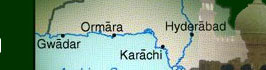
GEOGRAPHY
| Location |
Southern
Asia, bordering the Arabian Sea, between India on
the east and Iran and Afghanistan on the west and
China in the north |
| Geographic
coordinates: |
30
00 N, 70 00 E |
| Land
boundaries: |
Total:
6,774 km border countries: Afghanistan 2,430 km,
China 523 km, India 2,912 km, Iran 909 km |
| Coastline: |
1,046
km |
| Maritime
claims: |
Contiguous
zone: 24 NM territorial sea: 12 NM continental shelf:
200 NM or to the edge of the continental margin
exclusive economic zone: 200 NM |
| Climate: |
Mostly
hot, dry desert; temperate in northwest; arctic
in north |
| Terrain:
|
Flat
Indus plain in east; mountains in north and northwest;
Balochistan plateau in west |
| Elevation
extremes: |
Lowest
point: Indian Ocean 0 m highest point: K2 (Mt. Godwin-Austen)
8,611 m |
| Natural
resources: |
Land,
extensive natural gas reserves, limited petroleum,
poor quality coal, iron ore, copper, salt, limestone
|
| Natural
hazards: |
Frequent
earthquakes, occasionally severe especially in north
and west; flooding along the Indus after heavy rains
(July and August) |
| Environment
- current issues: |
Water
pollution from raw sewage, industrial wastes, and
agricultural runoff; limited natural fresh water
resources; a majority of the population does not
have access to potable water; deforestation; soil
erosion; desertification |
|
Top
|